PO Box 95
Lyttelton 8841
Te Ūaka recognises Te Hapū o Ngāti Wheke as Mana Whenua and Mana Moana for Te Whakaraupō / Lyttelton Harbour.
The Sumner Road Part 1, 1849-1867
By JC Betts
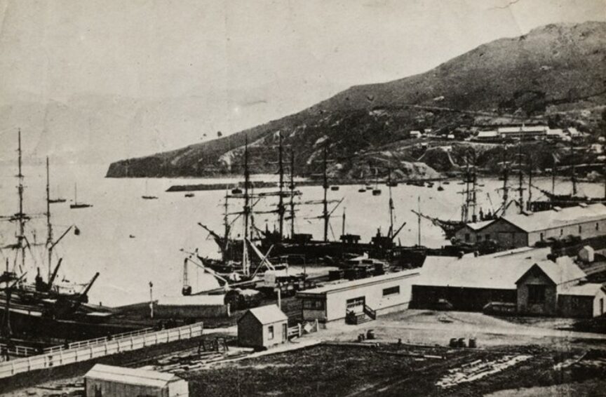
The most pressing problem for Waitaha Canterbury’s first settlers was access from the port to the plains and the site of Ōtautahi Christchurch. In July 1849, Captain Thomas first viewed a route via a 600 foot pass suggested by Master Evans, of the survey ship, Her Majesty’s Paddle Steamer, HMPS Acheron. Thomas believed a four mile road over Tapuaeharuru Evans Pass (with a tunnel through the summit) to Matuku Takotako Sumner and the remaining seven miles to the site of the city, could be built in time for the immigrants’ arrival.
Labourers were brought from Te Whanganui-a-Tara Wellington – around half of them were Māori. At first, tangata whenua appear to have been dubious about joining the road gangs. However, after a few weeks' work Thomas wrote “The natives residing here who have hitherto held back, are now so well pleased with the treatment of the working Natives, that they are now joining us in considerable numbers”. Colin Amodeo, Tracking Captain Thomas, Caxton Press, 2017, p.175.
In November, one gang downed tools, apparently offended by their supervisor’s swearing – the man, Joseph Compton, left his job. Another road gang worked on forming the uphill road east from Ōhinehou Lyttelton’s Oxford Street towards Officers Point, a spur of very hard rock. By blasting, they succeeded in forming the road as far as Sticking Point, known today as Windy Point, where a plane table affords interpretation of the harbour’s features. No 2 Road Party began at the top of the pass, flattening the summit and starting on the downhill sections on both sides.
The day before the settlers’ arrival, Chief Agent JR Godley dealt with a dispute – the European workers objected to Māori receiving the same wage as themselves, sixpence an hour. Godley fired the dissidents and hired more Māori. The European men returned to work the next day. Godley described the Māori at work, stating “they struck, shovelled &c., altogether, keeping time to a song ... most civil, good-natured fellows, laughing immoderately at our questions and chattering broken English very fast in reply”. Amodeo, ibid. p.193.
By late 1850, it was obvious that the road would not be completed in time. Charlotte Godley wrote:
“the great road is still very unfinished; several shoulders of rock that come in the way, and have to be blasted, stop it up completely, and in some places along the line even the path is quite a climb, with a rope to pull yourself up by." Charlotte Godley Letters from Early New Zealand, Whitcombe & Tombs, 1951, p.139.
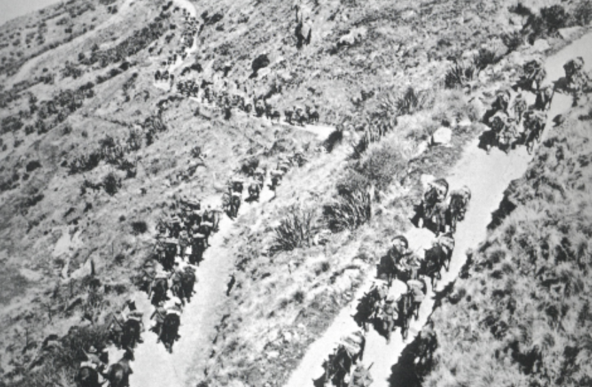
When the immigrants arrived in December 1850, the Bridle Path to Ōpāwaho Heathcote was the only land route to the plains. The Canterbury Association was wound up in 1853 and the new Provincial Council under Superintendent JE FitzGerald pressed on with the Sumner road. Provincial Engineer Edward Dobson chose a radically different (but much cheaper) route. The road on the harbour side skirted the coast to Gollans Bay at a level lower than the problematic bluffs, then rose to the top of the pass in a series of tight zig-zags. The original plan to build a tunnel through the summit never happened due to lack of funds.
On the Sumner side, Dobson chose a different route on the other side of the valley “modifying his gradient according to the character of the hill-side”, according to CC Bowen, Lyttelton Times, 8 September 1902. This has resulted in a very steep section and a hairpin bend near the summit. The original, partly-formed line is now the Captain Thomas Track. FitzGerald was so determined to see the road finished before he left for England, that in August 1857 he:
“insisted on risking his own life and that of his friends by driving a tandem over the half finished zig-zag ... with the assistance of volunteer grooms hanging on to the horses’ heads and a stalwart crowd hanging on to the dog cart behind". Lyttelton Times, 8 September 1902.
FitzGerald’s vehicle had two six-foot high red wheels and was known as the Circulating Medium. Pedestrians accompanied the travellers and they were given a rousing welcome and ceremonial dinner in Lyttelton. When FitzGerald returned to New Zealand in 1861 he found that Superintendent WS Moorhouse had started work on a railway line and tunnel to Lyttelton via Ōpāwaho Heathcote. FitzGerald so strongly disapproved that, despite having been the first editor of the Lyttelton Times, he started a second newspaper, the Press, in order to criticise the railway.
This first Sumner Road at least provided a daily carriage and mail service. Lady Barker made the journey in 1865:
“We started from Lyttelton and almost immediately began to ascend the zig-zag. It was a tremendous pull for the poor horses, who however never flinched; at the steepest pinch the gentlemen were requested to get out and walk, which they did, and at length we reached the top ... the driver looked to the harness of his horses, put on a very powerful double break, and we began the descent, which, I must say, I thought we took much too quickly, especially as at every turn of the road some anecdote was forthcoming of an upset or accident”. Lady Barker, Station Life in New Zealand, Virago 1984, pp 19-20.
With the completion of the Moorhouse Rail Tunnel in 1867, improving the route was no longer a priority, but after 70 years, and the advent of motor transport, attention was again given to the Sumner Road.

